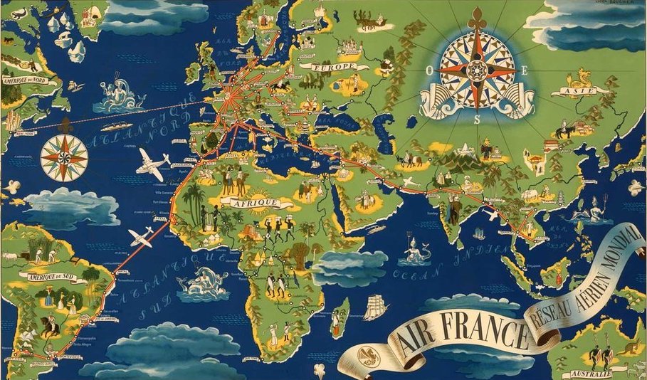
Maps and airlines are two of my favorite things. A new book maps the history of airline route maps.
When driving home from my son’s swimming lesson yesterday, I had Marketplace on and caught a segment on a new book on airline maps. My ears instantly perked up. The book is called Airline Maps: A Century of Art and Design, and is compiled and written by Mark Ovenden and Maxwell Roberts.
Here’s a small excerpt:
A new branch of cartography took off with the dawn of civil aviation a century ago. Airline maps were completely different from what came before, such as navigational maps used by pilots or even railroad route maps for train riders. Airline passengers did not need to know many specific details about their journey. All they were involved with were the airlines’ departure and arrival cities. To those with a fear of flying, perhaps the lack of detail was a clever psychological trick to entice them onto the fastest-moving machine ever invented.
Such a laissez-faire attitude to geographical accuracy gave rise to great experimentation, as the pages in this book testify. The very concept of whizzing rapidly from one side of the world to the other provided artists and marketers with inspiration. During the infancy of aviation, service maps were able to display in an instant both the proximity of the “colonies” and the viability of the new-fangled airlines over any surface-based transportation (especially the great oceangoing liners). Maps played a part in glamorizing flight and making it feel practical, and as networks matured, they were a valuable weapon in beating the competition.
The book is full of pictures, some of which you can view here.
I ordered the book on Amazon for $26.28 and will report back on whether it is worthwhile to order.
CONCLUSION
I love atlases and I love airlines, so I suspect this will be a great addition to my library. It’s a shame the cover of the book is so ugly, since many of the maps inside are beautiful.
Anyone else excited about this new book?


Definitely interested in seeing what you think. Please post a few images if you’re able to!
paperback only 🙁 but i love them!
Another great one for aviation and design minded people, is Airline Visual Identity: 1945-1975 by Matthias Hühne. I have the black hardcover version from Callisto Publishers. High quality printing and binding, and the commentary throughout is top notch. Always a conversation starter, even for non av-geeks! (I do have a lot of designer friends though…)
Thanks. Book Depository has this for AUD 71 ( USD 50, EUR 45) .They deliver free worldwide.
Paperback edition
My favorite map book I own is Transit Maps of the World which is also by Mark Ovenden so I imagine it’s great too.
Yes, please review it…
Awesome, thanks for flagging this. I love airline route maps. Ever since I was a kid, the first thing I do when settling down in my seat on a flight is to flip open the inflight magazine but from the back first, so I can look at the route map, fleet info, airport hub information etc. I love that stuff.
Somewhat related – want to read a great airline book ?…..Sky Gods by Robert Gandt about the history and downfall of Pan Am. Excellent narrative from the perspective of the top people to pilots, flight attendants and ground staff.
Honestly, I couldn’t put it down!
Awaiting your review of the book. The book cover is definitely a downer.
I picked up a copy of this yesterday and it really is an interesting browse. I can remember some of the later stuff for real – back in the day when BOAC stewards wore white jackets and carved joints of meat in F.